
St. Louis Volumetrics Surveys
Volumetric Measurements
Volumetric Drone Surveys:
Drone-based volumetric surveys are transforming how professionals measure and manage materials across job sites as well as monitoring watershed data. By capturing high-resolution aerial data and generating 3D models, drones provide accurate volume calculations that save time, reduce labor costs, and improve planning. Here’s how they’re being used in the real world:
Construction Sites
Track cut and fill quantities during site grading to stay on schedule and reduce rework.
Measure backfill in trenches and building pads for verification before inspections.
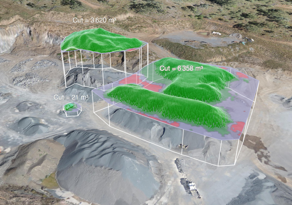
Monitor material stockpiles (e.g., gravel, topsoil, aggregate) for usage tracking and cost control.
Verify subcontractor billing based on actual material moved or used.
Civil Engineering Projects
Calculate volumes for embankments, roadbeds, and bridge approaches during infrastructure development.
Estimate fill requirements for highway widening or overpass construction.
Compare as-designed vs. as-built earthwork volumes to catch discrepancies early.
City Maintenance & Public Works
Measure landfill cell usage and remaining capacity for efficient planning and reporting.
Track mulch, salt, sand, or gravel stockpiles stored at city or county maintenance yards.
Monitor sediment build-up in stormwater retention basins or drainage channels.
How Drone Volumetrics Help Monitor Watershed Data:
Erosion and Sediment Control
Drones can measure volumetric changes in soil over time, helping environmental engineers monitor erosion or sediment build-up in drainage areas, retention basins, or streams.
Retention Basin & Detention Pond Volume
By calculating the exact volume of these features, municipalities and public works departments can assess if they meet stormwater management requirements.
Floodplain Modeling Support
Drones capture high-resolution elevation models (DTMs and DSMs), which—combined with hydrological models—help identify areas prone to flooding and analyze how water flows across a watershed.
Streambank and Channel Morphology
Changes in volume around streambanks or channels can be tracked over time, showing how storms or seasonal flows are altering the landscape.
Construction Site Stormwater Compliance (SWPPP)
Volumetric mapping ensures that silt fences, swales, and sediment traps are functioning and that water flow isn’t increasing erosion or non-compliance risks.
